FEB 13th, 2021
CANCELLED! Yes, we’re cancelling an already cancelled event, because that’s the kind of year it’s been :). In seriousness, we woke up this morning to -38C, feels like -50C. Without a doubt if the race hadn’t already been cancelled we’d be calling it off this morning. With that in mind we’re now cancelling our own personal ride too.
Obviously we can’t keep other people from leaving their houses and doing their own thing but we wanted to try to lead by example and say that it’s just too dangerous out there.
We’ll leave the map below (that we personally intended to follow) up here to serve as an example of future race ideas, but know that what we end up with next year is completely up in the air at this point.
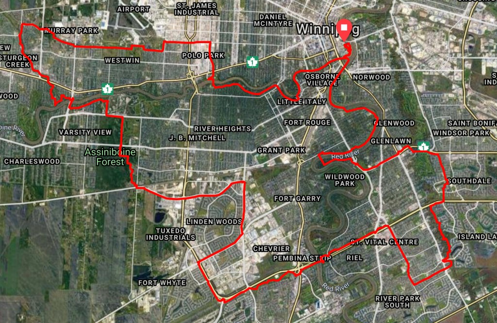
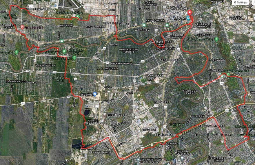
About the map below: It’s a 65km course that we’ve ridden ourselves, completely within city limits, mostly on designated bike and multi-use paths, protected bike lanes, and ‘low stress” roads. It goes through The Forks, the Assiniboine Forest and Park, along Sturgeon Creek, Omand’s Creek, the Red, Seine, and Assiniboine Rivers, the Yellow Ribbon Greenway, Wellington Crescent, and other scenic areas. There are also some less scenic parts to connect the dots.
It’s possible that we’ve made errors in our mapping (we plotted the map by hand, as opposed to actually riding with a GPS tacker as we’d do when preparing a final race route) so if you choose to use the map as an idea for your own ride or run trust your own judgement first and don’t rely on the map as though it’s a final, proofed copy. It’s not. It’s simply here as reference for future ideas, yet to be completely sorted out.
Even if we’ve mapped everything correctly there can always be unanticipated construction, closures, detours, and other hazards, and even at the best of times there are other people and motorists (and dogs, and…) on the route who can pose their own dangers to watch out for.