
Race participants should use the official Cue Sheets and GPS Maps posted in the Race Bible to navigate, NOT the maps and info in this Guide. There are often reasons beyond our control to make last minute changes to the Cue Sheets and GPS, and we’ll let all participants know before the race if that’s the case, but last minute changes may not be updated to the guide below.
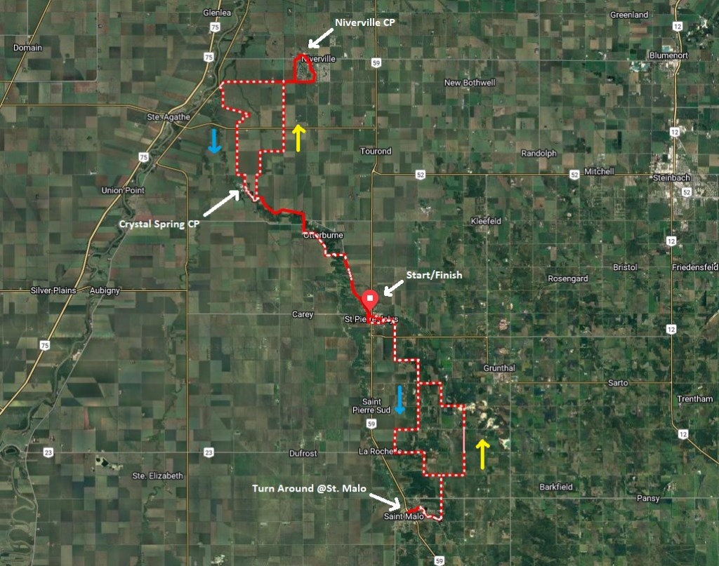
With a return to the Crow Wing Trail this year, the race route consists of gravel & dirt roads, trail and pavement going into/out of towns along the route. In keeping with the success of last year’s loop format, we decided to set up a 114km loop where participants will either do a partial lap (short distance), one lap (mid-distance), one and a bit laps(long run) or two laps (long bike).
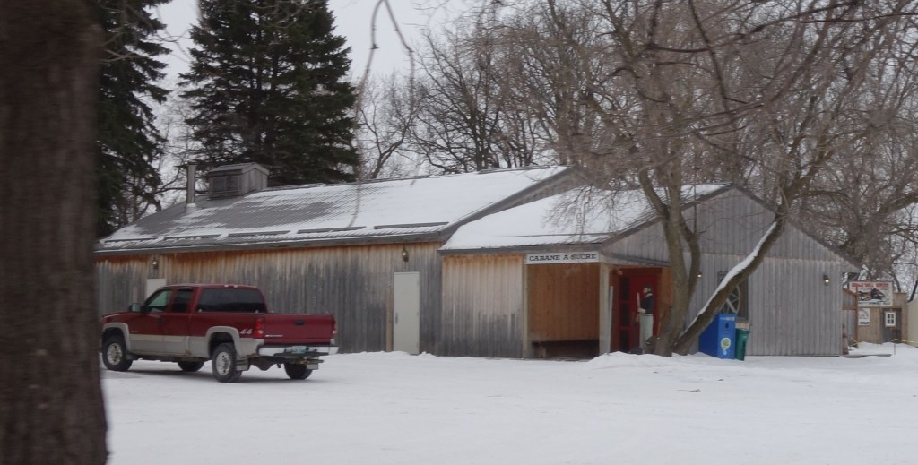
CHECKPOINTS: We will have three indoor CheckPoint facilities with washrooms available. This includes the Start/Finish, located at the Sugar Shack in the Museum at St. Pierre-Jolys. Our checkpoint in Niverville is located in the lobby of the Curling Club next to the Arena in town. The final checkpoint is located at the Crystal Spring Colony.
In addition to our checkpoints, there are businesses along the route that might be open when you pass by in case you want to purchase food/drink/etc. We have no relationships with these businesses but encourage participants to take advantage of them if so desired.
Short Course: (Approximately 50km out and back): Yellow arrows show outbound direction and Blue arrows show return. Checkpoint location is at Crystal Spring Colony
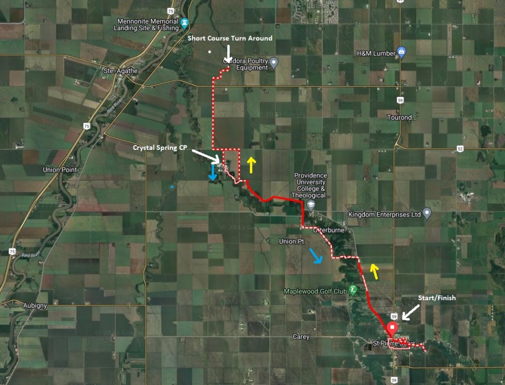
Mid/Long Course: (1 or 2 laps, approx 114km per lap): Yellow arrows show outbound direction and Blue arrows show return. Checkpoint locations are at Niverville Curling Club, Crystal Spring Colony and the Sugar Shack in St. Pierre-Jolys at the Start/Finish for 2-lap racers
CHECKPOINT FOR CYCLISTS AND RUNNERS: At the start of the event all participants must check in at the Sugar Shack in St. Pierre-Jolys to let our timers know they’re present and ready to start!
Start/Finish – St.Pierre-Jolys – Cabane a Sucre (Sugar Shack)
We start and finish the race at the Sugar Shack at the Museum in St. Pierre-Jolys. This has been the site of one of our checkpoints in a number of earlier editions of Actif Epica and seemed like a natural place to host our start/finish for a loop format event centred on the Crow-Wing Trail.
Racers on our short-distance course will turn back before reaching the Niverville checkpoint. There will be a sign at the turn-around point. This is also the turn-around spot for the 100 mile run course as they have an out-and-back from St. Pierre at the start of the loop to add distance that makes up the additional 46km.
Checkpoint – Niverville Curling Club
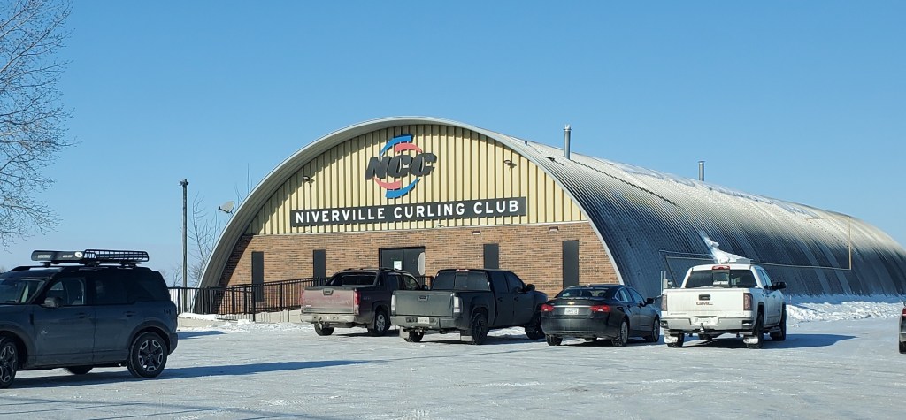
Racers doing 1 lap on foot/bike or 2 laps on bikes will travel South to St. Malo, then return to the Sugar Shack at St. Pierre and the next checkpoint is in Niverville in the Lobby of the Curling Club, pictured above. This is located just North of the traditional checkpoint that we have hosted in the Niverville Arena. There will be signs out front and the cue sheets and GPX track indicate how to locate the Curling Rink.
Checkpoint – Crystal Spring Colony
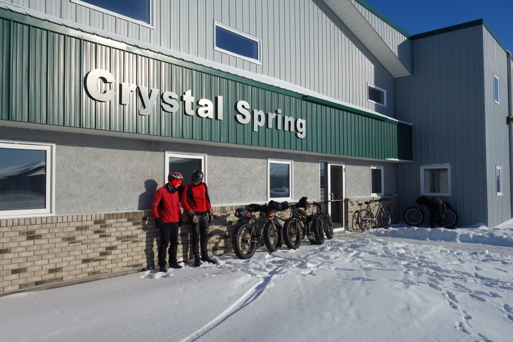
The final checkpoint on our race loop is a stop in at Crystal Spring inside the shop door pictured above. Leaving here, racers will head South onto the trails next to the Rat River, prior to heading out onto the return trip to St. Pierre for either the half-way point or the finish.
